Home Print logo
Selkirk College

Utility

  • About Selkirk
  • Moodle
  • Quick Links
  • Careers
  • Contact Us
  • News
  • Events

CTA

  • Apply
  • Give
  • Are You Okay?

Main navigation

  • Why Selkirk Chevron Down Created with Sketch.
    • The Selkirk Experience
    • Let's Connect
    • Our Campuses
    • Our Places
    • Our Priorities
    • Viewbook
  • Programs & Courses Chevron Down Created with Sketch.
    • Program Areas
    • Academic Upgrading & Development
    • Arts & Technology
    • Business
    • Environment & Geomatics
    • Health & Human Services
    • Hospitality & Tourism
    • Industry & Trades Training
    • University Arts & Sciences
    • Community Education & Workplace Training
    • Co-op Education
    • Dual Credit
    • Open Studies
    • Start in Spring & Summer
    • Start in Winter
    • Explore All Programs
  • Apply & Register Chevron Down Created with Sketch.
    • Apply
    • Register
    • Important Dates
    • Student Records
    • Academic Calendar
    • Academic Regulations
    • Contact Us
  • Tuition & Financial Aid Chevron Down Created with Sketch.
    • Tuition & Fees
    • How to Pay
    • Financial Aid & Awards
  • Student Life & Support Chevron Down Created with Sketch.
    • Student Supports
    • Events Calendar
    • Campus Services
    • Student Life
    • Housing
    • Convocation
    • Alumni
  • International Chevron Down Created with Sketch.
    • International Students
    • Study Abroad
    • Our Team

Search

  1. Home /
  2. Programs & Courses

    /
  3. Environment & Geomatics /
  4. Geographic Information Systems /
  5. Geographic Information Systems – Advanced Diploma

Geographic Information Systems

Main navigation

  • Geographic Information Systems – Advanced Diploma

Geographic Information Systems - Advanced Diploma

Flexible and adaptable, GIS can be used in a variety of different scenarios, to make evidence-based decisions, understand trends and analyze data, effectively communicate a message and visually tell a story.
Program at a Glance
Length
1 year
Credential
Advanced Diploma
Delivery Method
On Campus
Campus
Castlegar
Intake Dates
Fall
Contacts
Rena Vandenbos
School Chair, Researcher, Instructor, Geographic Information Systems
Phone
1 (250) 365-7292
21279
Direct
1 (250) 365-1279
Contact by email
Allison Lutz
Student Coordinator, Instructor
Phone
1 (888) 953-1133
21276
Direct
1 (250) 365-1276
Contact by email
    Overview

    GIS allows experts to map any type of spatial data so that it is interactive, complex and layered with valuable information. Be a specialist in demand in this field that touches a variety of industries from business to health care and environmental sciences. It can be used as a tool within almost every industry, including:

    • Businesses like market-driven banking, ultimate client service and asset management
    • Engineering like transportation planning, disaster management, use of historical data and terrain analysis
    • Urban, rural and community planning
    • Climate research, flood damage estimation
    • Wildlife conservation, natural resource planning, water management
    • Resource development and land management
    • News and entertainment support, telecom and network services
    • Government administration, taxation
    • Health and medical research
    • Law enforcement, accident analysis

    Professional Training & Hands-on Experience

    Within our state-of-the-art facilities, you'll get powerful, progressive hands-on experience and classroom instruction in subjects like: 

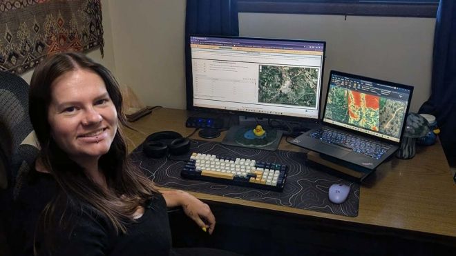
    • GIS applications and automation
    • Remote sensing 
    • Internet mapping
    • Database development and management
    • Customized application programming 
    • Global positioning systems (GPS) 
    • 3D visualizations
    • Data management techniques
    • Open source, open data, and related software applications 
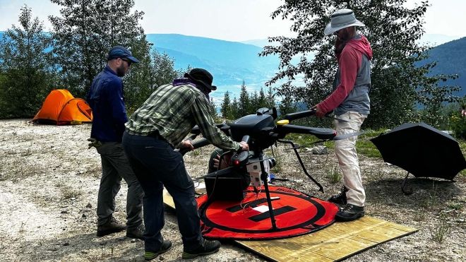
    • Drone data collection and utilization

    Student smiling and giving thumbs up
    Enrol in Co-op!
    Take your learning out of the classroom with co-op education. Earn school credit while you gain real-world work experience. Geographic Information Systems students must enrol in a Co-op Education work-term in Semester 3.
    Find Out More

    News

    Three GIS Students holding their tangible map
    Students Transform Maps from Screens to Physical Models
    Tue, 04/08/2025 - 12:00
    Students created a stunning collection of detailed, layered maps and 3D prints that provide an interactive way to visualize geographic information.
    GIS team works on setting up the drone
    GIS Alumna Supporting Forestry Intelligence Research
    Thu, 01/09/2025 - 12:00
    Selkirk College alumna Alana Block is using her education to in the School of Environment & Geomatics to work towards positive change.
    A graduate works in the forest
    Applying Cutting-Edge Technologies in Fisheries and Forestry
    Thu, 10/17/2024 - 12:00
    Implementing new software and developing processing workflows has been expanding the reach of drone-based remote sensing.
    Program Outcomes

    Upon successful completion of this program, learners will be able to:

    1. Engage and communicate effectively and ethically with diverse audiences in a professional context
    2. Apply critical thinking and diverse problem-solving approaches to address technical issues
    3. Organize project resources into a coherent framework that includes data, technologies, systems and participants
    4. Apply automation and data analysis processes, and leverage GIS and Remote Sensing capabilities to address diverse challenges and provide decision support, including real world scenarios related to sustainable development.
    5. Apply processes of spatial data creation and acquisition by utilizing a range of methods
    6. Create visually appealing, accurate, and intuitive representations of spatial data through maps, 3D models, apps and various types of portals to effectively communicate with specific audiences.
    7. Apply data management best practices relating to data standardization, database design, ethics, workflows, interoperability and sharing
    8. Utilize learning experiences that enhance self-sufficiency and future opportunities
    9. Recognize the diversity of Indigenous culture and traditions as distinct knowledge systems that are valid when building respectful engagement, consultation and collaborative relationships.
    10. Acknowledge the Calls to Truth and Reconciliation and the United Nations’ Declaration on the Rights of Indigenous Peoples as inclusive and informed constructs for Indigenous rights and title in the stewardship.
    Admission Requirements

    In addition to meeting the general admission requirements to Selkirk College, the applicant must meet the following program requirements to be considered fully-qualified:

    • The minimum requirement for entry into the ADGIS is successful completion of 60 credits from a diploma/associate degree or applied/academic degree from an accredited post-secondary institution with an average GPA of at least 2.33.
    • International students will be expected to provide documentation of English proficiency as per Policy 8611.
    Additional Requirements

    General

    An applicant with a reasonable potential for success on the basis of work experience or equivalent education may be admitted, notwithstanding some deficiency in prior formal education.  For this option, they should have demonstrated competency in the use of computer software and hardware technologies, including spreadsheets, word processing, and computer graphics. Applicants with no accredited post-secondary credential will usually require academic upgrading prior to starting the program. They are urged to apply for the program at least one year in advance.

    Applicants with no accredited post-secondary credential may require academic upgrading prior to starting the program. They are urged to apply for the program at least one year in advance

    APPLICATION PROCESS

    1. Before an applicant's file is considered to be complete, the following must have been received by the Admissions office:

    a) completed application form;

    b) official transcripts of all relevant post-secondary education; and

    c) official transcripts of high school grades will be required for applicants entering without a credential from an accredited post-secondary institution.

    2. Deadline for completing the application file is normally one month prior to the commencement of the program.

    3. Late applications will be accepted if space is available.

    Graduation and Promotion

    In order to receive your credential in your program, you must maintain a minimum GPA of 2.00.

    PROMOTION

    1. Each semester must be completed with a Grade Point Average of 2.00 (60% average) or better with no more than two grades below a 60% to continue into the next semester. GPA will be based on all grades for courses scheduled for a given year and semester as per the course calendar. All grades below a 60% grade must be raised to a satisfactory level in order to graduate (see below).

    2. Students not eligible to continue to the next semester will not be permitted to upgrade any marks but must repeat all courses with grades below a 60% prior to proceeding to the next semester.

    3. Students receiving a final grade of 59% or lower in the prerequisite course will be required to withdraw from the subsequent course requiring the prerequisite. Students receiving the 59% or lower grade must re-register in and successfully complete the course with a 60% grade or better before going on to the subsequent course.

    GRADUATION

    All courses must have at least a 60% grade, except for GIS 320 and Coop 301, which needs a “CRG” to be eligible for graduation.

    Courses
    Program Courses

    The following courses are required for the Geographic Information Systems – Advanced Diploma and terms 1, 2 and 3 of the Geographic Information Systems – Bachelor's Degree. See the bachelor's degree for the required courses in terms 4 and 5.

    Term 1

    GIS302 - Introduction to Geographic Information Systems

    GIS 302 Introduction to Geographic Information Systems is an introduction to GIS theory and application. Emphasis will be placed on understanding how geospatial features are represented and captured as data and how these data can be managed, analyzed and presented using state-of-the-art GIS tools. Hands-on expertise will be developed with ESRI's ArcGIS for Pro software. This material is continued in GIS 303. This course or equivalent credit is required to continue in the ADGIS program.

    Prerequisites
    Admission into ADGIS/GWAC/BGIS program
    Credits
    3.00

    GIS303 - GIS Analysis and Automation

    GIS 303 GIS Analysis and Automation will build upon the fundamentals of GIS theory by examining geodata models, data management and metadata, advanced analysis (raster and vector), 3D models, batching and scripting. The lab portion of this course will focus on the use of ArcGIS and its extensions for vector and raster analysis, Model Builder for analysis workflow control, and Python scripting for automation.

    Prerequisites
    GIS 302 with a minimum of 60% or equivalent
    Credits
    3.00

    GIS306 - Introduction to Remote Sensing

    GIS 306 Introduction to Remote Sensing will introduce the fundamentals of the basic physical principle of remote sensing and demonstrate the current applications of the technology. Students will become familiar with the basic image processing techniques for image pre-processing and data extraction. The course is designed to stimulate the current remote sensing activities in natural resource management.

    Prerequisites
    Admission into ADGIS/BGIS program
    Corequisites
    GIS 302
    Credits
    3.00

    GIS310 - GIS Data Management

    GIS 310 GIS Data Management. Over the last few decades, geospatial technologies have evolved and infiltrated into an exponential number of organizations' and people's lives to the point where they are ubiquitous. Along with this great expansion of use comes an even greater need to access the right data and to manage and utilize it appropriately for each unique project. This course is an introduction to the fundamentals of dealing with spatial data and data management principles. We will explore key topics related to working with spatial data including data discovery, data dissemination and data use. Along with these topics comes the need to discuss ethics of data use and data use guidelines, data formats, standards and translation, metadata, as well as general data management and maintenance principles. The commercial software - FME will be introduced for data manipulation and translation from one format to the other.

    Prerequisites
    Admission into ADGIS/BGIS program
    Credits
    3.00

    GIS316 - Introduction to CAD for GIS Professionals

    GIS 316 Introduction to CAD for GIS Professionals. This course provides an introduction to Autodesk's computer-assisted design and drafting software for GIS students. Students will learn the fundamentals of the drafting environment, including setting up their workspace, utilizing common tools, creating and modifying entities and text, and crafting print layouts. AutoCad Map3D will be explored for LiDAR data manipulation. This course will frequently touch upon the differences and similarities of CAD and GIS as well as when and how GIS professionals may use CAD in their career and how transitions between the two environments may occur. By the end of the course students should gain appreciation of the complementary technology that CAD offers alongside GIS

    Prerequisites
    Acceptance to ADGIS Program
    Credits
    3.00

    GIS318 - Cartography and Geovisualization

    GIS 318 Cartography and Geovisualization is the art and science of map making and map use. Preparation of high quality maps that readily reveal land management, planning, environmental or other concerns is critical to ensure that important messages are conveyed in an easily interpretable fashion. This course introduces the concepts and methods of cartographic communication, design, and geovisualization. Mapping fundamentals will address subjects such as coordinate systems, projections, datums, cartographic generalization, map types, and map design considerations. All cartographic principles and practices will be examined in relationship to GIS and other geospatial technologies. We will use ArcGIS software to complete most of the activities.

    Prerequisites
    Admission to ADGIS Program
    Corequisites
    GIS 302
    Credits
    3.00

    GIS329 - Principles Of Programming

    GIS 329: Principles of Programming for GIS assumes no prior programming knowledge. Students will learn how to set and use variables, write and import modules, and use selection and repetition to control program flow as implemented in the Python language. At a more advanced level, students will learn to write programs that embed functions and object-oriented programming (OOP) concepts such as the use of objects, properties, and methods. Topics of scripting in Python and the usage of ESRI's ArcPy module for the automation of geoprocessing and mapping tasks will be introduced.

    Prerequisites
    Admissions into ADGIS/BGIS program
    Corequisites
    GIS 302
    Credits
    3.00

    GIS390 - Applied Research Methods

    GIS 390 Applied Research Methods involves the design and planning of a project idea from initial concept to anticipated final outputs. Topics include an overview of the steps necessary to successfully integrate GIS into the project decision-making process. Specific skills will be developed in project scoping and research proposal development, reference material management, and project presentation methods, including oral, poster, and written project documents. This course is a prerequisite for Co-op 301, GIS 491, and GIS 492.

    Prerequisites
    Admission into ADGIS/BGIS program
    Credits
    1.00
    Term 2

    GIS307 - Remote Sensing in Resource Management

    GIS 307 Remote Sensing in Resource Management. Building upon the skills introduced in Introduction to Remote Sensing (GIS 306), this course will cover topics in the biophysical, geophysical, and human activity applications of remote sensing as well as change detection, object-oriented analysis, and active and passive imaging. Lectures will be integrated with labs emphasizing practical experience in remote sensing software applications using ENVI 5.x and QGIS 3.x. This course consists, in part, of an independent project designed and conducted by individual students to foster a scientific research approach in executing a remote sensing project. Each student will identify a project to be approved by the instructor during the first week of the class. Students are expected to work individually to complete their chosen project. The instructor will periodically discuss project progress and provisional results in the class.

    Prerequisites
    GIS 305 or GIS 306. Note: Pre-requisite(s) may be waived with the permission of the Instructor.
    Credits
    3.00

    GIS313 - Data Base Systems

    GIS 313 Database Systems is an integral part of GIS, an associated relational database system is used for query and analysis operations that aid in solving spatial problems. This introduction to relational database systems includes topics of: database concepts, data definition, structured query language (SQL), and data integration.

    Prerequisites
    Admission into ADGIS/BGIS program
    Credits
    3.00

    GIS314 - Databases II

    GIS 314 Database II.  This course is a continuation of Database Systems I, and will cover relational database geodatabase skills using mainly Microsoft Access and ESRI Geodatabases with ArcSDE and a PostgreSQL backend. The purpose of this course is to introduce both conceptual and practical aspects of designing and developing both a database and a geodatabase. The course will provide an overview of some design methodologies and models. Following this overview, the course will cover database and geodatabase design and implementation using Access/Geodatabases and optionally ArcSDE on top of PostgreSQL.

    Prerequisites
    GIS 313
    Credits
    3.00

    GIS320 - GIS Professional Development

    GIS 320 GIS Professional Development. Current and relevant professional development in GIS is essential for new graduates and experienced practitioners to achieve and maintain success in the continually changing GIS field. During this seminar course we will invite local GIS industry expert guest speakers to learn how their organization uses GIS technology and what skills are most required for success. We will also cover designation upon graduation, developing a professional development plan, and identify various GIS organizations.

    Prerequisites
    GIS 302 with a minimum of 60% or equivalent
    Credits
    1.00

    GIS321 - New Media for GIS

    GIS 321 New Media for GIS. In our continually evolving digital world, employers and clients often expect GIS graduates to have an online presence. We need a venue to showcase what we do and what we are capable of, and how we format and present our online portfolio can be make or break a new position or contract award. This New media course consists of a series of workshops designed to build digital presentation and presence skills using some popular New media tools, graphics editors, video editing software, websites and blogs plus additional freeware social media tools like Twitter and LinkedIn. At the end of this course students will have built their own websites hosting creative self-produced media and begun the process of building an online GIS network to begin or further their GIS careers.

    Prerequisites
    Admission into ADGIS/BGIS program
    Credits
    3.00

    GIS323 - Introduction to Global Navigation Satellite Systems and Unmanned Aerial Vehicles

    GIS 323 Introduction to Global Navigation Satellite Systems and Unmanned Aerial Vehicles will first introduce the fundamental concepts of Global Navigation Satellite Systems with specific emphasis on Global Positioning System (GPS) and the applied technologies for GPS data collection and GIS integration. Through interactive instruction and hands-on course exercises, students will work with a variety of GPS tools and field collection techniques to learn how to create, edit, update and manage geographic information. Emphasis areas will include familiarity with GPS receivers, GPS processing software, data collection standards and cartography. The second part of the course will introduce Unmanned Aerial Vehicles (UAV) technology. More specifically, this includes introduction to photogrammetry, characteristics of images obtained from UAV, mission planning, acquiring images using UAV and digital image processing. Students will work on series of assignments to get the hands on experience on data acquisition and image processing.

    Prerequisites
    GIS 302 (if online version of GIS 323)
    Corequisites
    GIS 302
    Credits
    3.00

    GIS325 - Internet Mapping

    GIS 325 Internet Mapping investigates the full range of Internet and intranet mapping, including static maps, online data, and web map (image) and feature services. Most of the emphasis of the course will be on the use of ESRI's ArcGIS Server software to serve maps over the Internet. Free mass media applications Google Earth and Google Map applications will be introduced. Web map OpenGIS Consortium standards and freeware server and viewer software will be discussed. The course curriculum will be delivered using lectures and hands-on class exercises. Students will author, administer, design and manage interactive Web Mapping projects through a number of lab assignments, and through a term project. The term project will be the development of a site which will be served through the campus intranet and/or through the SGRC public server. The course requires prior knowledge of GIS theory, BC datasets, and ArcGIS software which students have previously acquired in ADGIS courses GIS 302, 303, 310 and 318.

    Prerequisites
    GIS 302, GIS 303, GIS 310, and GIS 318 with a minimum of 60%
    Credits
    3.00

    GIS331 - Advanced Topics In GIS

    In GIS 331 Advanced GIS Application we will learn about and practice applying GIS to spatial problems; arguably one of the most challenging parts of putting this powerful technology into action. We will focus on GIS for Health Analysis as well as other applications of GIS (such as crime analysis) by utilizing sophisticated analysis techniques including hotspot analysis, Getis-Ord G* statistic, exploratory regression, Ordinary Least Squares (OLS) and Geographically weighted regression (GWR).

    Prerequisites
    Admissions into ADGIS/BGIS program
    Credits
    3.00
    Term 3

    GIS491 - Technical Project

    GIS 491 Technical Project builds on the specific skills developed in GIS 390 and involves building a project database, conducting analyses with a variety of geoprocessing tools, and producing final products. This course provides an opportunity for students to integrate their knowledge of CAD, GIS, remote sensing and databases to solve a specific problem. Students will combine practical application with project management skills to complete their project with the guidance of a supervisor.

    Prerequisites
    GIS 390 with a minimum of 60%
    Credits
    3.00
    or

    COOP301 - GIS Co-op Work-term I

    COOP 301 is a (paid) work-term which fosters partnerships between students, employers and institution; to bring classroom learning into the workplace. Co-op Education is a process of education that formally integrates students’ academic study with periods of related work experience. By connecting with employers, students will gain valuable hands-on experience in the field of Geographic Information Systems (GIS).

    Prerequisites
    The student must have completed a minimum of one semester in the School of Environment and Geomatics, GIS Program with a minimum cumulative GPA of 2.0, completion of all courses. Any student with one (1) or more failing grades must have Advisor approval to enter into a Co-op Work Term.
    Credits
    6.00
    Tuition & Fees
    Domestic
    International
    Domestic
    2024/25
    Geographic Information Systems – Advanced Diploma, Year 1
    Tuition
    $6,001
    Mandatory Fees
    $616
    Student Union Fees
    $455
    Total
    $7,072
    2025/26
    Geographic Information Systems – Advanced Diploma, Year 1
    Tuition
    $6,121
    Mandatory Fees
    $628
    Student Union Fees
    $455
    Total
    $7,204
    International
    2024/25
    Geographic Information Systems – Advanced Diploma, Year 1
    Tuition
    $13,641
    Mandatory Fees
    $633
    Student Union Fees
    $455
    Total
    $14,729
    2025/26
    Geographic Information Systems – Advanced Diploma, Year 1
    Tuition
    $14,988
    Mandatory Fees
    $930
    Student Union Fees
    $543
    Total
    $16,461

    All amounts are estimates and are subject to change. Tuition amounts are based on a full-time course load. Please note that many programs have additional costs beyond those listed here. For more information, please visit Tuition & Fees.

    Find Out More

    We look forward to connecting with you! Fill out this form and we'll reach out to you.


    A member of our recruitment team will be contacting you shortly, keep an eye on your inbox!

    SVG
    Land Acknowledgement icon
    Selkirk College acknowledges the traditional territories of the Sinixt (Lakes), the Syilx (Okanagan), the Ktunaxa and the Secwépemc (Shuswap) Peoples.
    selkirk College

    Social Media

    • Facebook
    • Twitter
    • Youtube
    • Instagram

    Footer menu

    • Quick Links
      • Careers
      • IT Service Desk
      • Programs A-Z
      • Marketing & Communications Service Desk
      • MySelkirk
      • Staff Directory
    • Student Links
      • Academic Calendar
      • Bookstore
      • Important Dates
      • Learning Commons & Library
      • Moodle
      • Webmail

    301 Frank Beinder Way
    Castlegar BC V1N 4L3
    Canada

    (250) 365-7292
    1 888 953-1133
    (250) 365-6568
    Contact by email

    © SELKIRK COLLEGE. ALL RIGHTS RESERVED.

    Legal

    • Policies
    • Terms of Use
    • Privacy
    • Why Selkirk
      • The Selkirk Experience
      • Let's Connect
        • Find Out More
      • Our Campuses
        • Castlegar Campus
        • Grand Forks Campus
        • Kaslo Learning Centre
        • Nakusp Learning Centre
        • Silver King Campus
        • Tenth Street Campus
        • Trail Campus
        • Victoria Street Campus
      • Our Places
        • Mir Centre for Peace
          • Unarmed Civilian Peacekeeping
            • UCP Database
          • History
            • Donors
            • Remembering Dr. Myler Wilkinson
          • Resources
          • Student Awards
          • Statements
          • Our Team
        • The Gathering Place
        • Selkirk Technology Access Centre
          • Research & Development
          • SMARTS Program
          • Interactive Visits
        • Shambhala Music & Performance Hall
        • Tenth Street Indigenous Gathering Space
        • Skattebo Education Forest
          • Education & Research
          • History
          • Recreation & Operations
          • Woodlot 400
          • FAQs
          • Directions & Contact Us
        • Applied Research & Innovation Centre
          • Research & Development
          • Interactive Visits
        • Scholar's Dining Room
        • Hair Salon
      • Our Priorities
      • Viewbook
    • Programs & Courses
      • Program Areas
      • Academic Upgrading & Development
        • Academic Upgrading
          • BC Adult Graduation Diploma
          • Pathways to High-Demand Careers
          • College Success
          • Our Team
        • Steps to Opportunities, Academics and Readiness (SOAR)
          • Our Team
        • Commercial Kitchen Assistant
      • Arts & Technology
        • Blacksmithing & Metal Art
          • Portfolio Guidelines
          • Faculty
          • Photo Gallery
        • Ceramics
          • Portfolio Guidelines
          • Photo Gallery
          • Faculty
        • Contemporary Music & Technology
          • Performance Major
          • Production Major
          • Composition Major
          • Songwriting Major
          • General Music Major
          • Advanced Diploma
          • Auditions
          • Berklee College of Music Academic Partnership
          • FAQs
          • Facilities
          • Transfers & Exchanges
          • Faculty
          • Photo Gallery
        • Digital Arts
          • Portfolio Guidelines
          • Transfers & Exchanges
          • Faculty
          • Photo Gallery
        • Digital Fabrication & Design
          • Student Expectations
          • Transfers & Exchanges
          • Faculty
          • Photo Gallery
        • Full-Stack Web Development
        • Textile Arts
          • Portfolio Guidelines
          • Photo Gallery
        • Web Development
      • Business
        • Business Administration
          • Business Administration - Advanced Diploma
          • Business Administration Accounting Finance - Diploma
          • Business Administration Professional Management - Diploma
          • Dual Credit Course - Intro to Business
          • Transfers & Exchanges
          • Faculty
        • Office Administration & Technology
          • Bookkeeping Advanced Certificate
          • Bookkeeping Certificate
          • Bookkeeping Skills Associate Certificate
          • Office Assistant Certificate
          • Word Processing Skills Associate Certificate
          • FAQs
          • Important Dates
          • Faculty
        • Accounting – Postgraduate Diploma
          • FAQs
          • Faculty
        • Business Management – Postgraduate Diploma
          • FAQs
          • Faculty
        • Career Launch
        • Hire a Student
        • Dean's Honour Roll & Dean's List
      • Environment & Geomatics
        • Applied Environmental Science and Planning Technology
          • Important Dates
          • Careers
          • Faculty
        • Forest Technology
          • Important Dates
          • Careers
          • Faculty
        • Geographic Information Systems
          • Geographic Information Systems – Advanced Diploma
          • Geographic Information Systems - Bachelor's Degree
          • Geomatics in the Workplace - Advanced Certificate
          • Faculty
        • Recreation, Fish & Wildlife
          • Important Dates
          • Careers
          • Faculty
        • FAQs
      • Health & Human Services
        • Bachelor of Science in Nursing
          • Application Information
          • Additional Information
          • Nursing Student Life
          • Important Dates
          • FAQs
          • Faculty
        • Community Support Worker Associate Certificate
          • Faculty
        • Early Childhood Care & Education
          • Application Information
          • Early Childhood Care and Education – Inclusive Practice Advanced Certificate
          • Early Childhood Care and Education – Infant/Toddler Advanced Certificate
          • Teaching, Learning & Assessment Approach
          • Transfers & Exchanges
          • Important Dates
          • FAQs
          • Faculty
        • Early Learning & Childcare - Diploma
        • Education Assistant & Community Support Worker
          • Application Information
          • Transfers & Exchanges
          • FAQs
          • Faculty
        • Gerontological Nursing - Postgraduate Diploma
          • Application Information
          • FAQs
          • Faculty
        • Health Care Assistant - Certificate
          • Application Information
          • Funding Opportunities
          • Important Dates
          • Faculty
        • Health Care Assistant - Diploma
          • Application Information
        • Human Services Diploma
          • Child and Youth Care Specialty – Human Services Diploma
          • Early Childhood Care and Education (Inclusive Practice) - Human Services Diploma
          • Early Childhood Care & Education (Infant and Toddler) – Human Services Diploma
          • Social Service Worker - Human Services Diploma
          • Transfers & Exchanges
          • Faculty
        • Mental Health & Addictions
          • Application Information
          • Faculty
        • Mental Health and Substance Use - Certificate
          • Application Information
          • Faculty
        • Nursing Unit Clerk
          • Application Information
          • Additional Information
          • Important Dates
          • FAQs
          • Faculty
        • Pharmacy Technician
          • Application Information
          • Important Dates
          • FAQs
          • Faculty
        • Practical Nursing
          • Application Information
          • FAQs
          • Faculty
        • Social Service Worker Certificate
          • Application Information
          • Transfers & Exchanges
          • FAQs
          • Faculty
      • Hospitality & Tourism
        • Culinary Management
        • Postgraduate Diploma - Culinary Management
        • Postgraduate Diploma - Hospitality Management
          • Faculty
        • Professional Cook Program
          • Important Dates
          • Faculty
        • Resort & Hotel Management
          • Transferability
          • Transfers & Exchanges
          • Faculty
        • Ski Resort Operations & Management
          • Transferability
          • Tales of SROAM Success
          • Photo Gallery
          • Faculty
        • Ski Industry Courses
      • Industry & Trades Training
        • Carpentry Foundation
          • Important Dates
          • Faculty
        • Carpentry - Apprenticeship Level 1 to 4
          • Important Dates
          • Faculty
        • Electrical Foundation
          • Important Dates
          • Faculty
        • Electrical - Apprenticeship Levels 1 to 4
          • Important Dates
          • Faculty
        • Fine Woodworking
          • Important Dates
          • Featured Works
          • Faculty
        • Hairstylist Foundation
          • Important Dates
          • Faculty
        • Hairstylist - Apprenticeship Level 2
        • Heavy Mechanical Foundation
          • Important Dates
          • Faculty
        • Metal Fabricator Foundation
          • Important Dates
          • Faculty
        • Millwright/ Machinist Foundation
          • Important Dates
          • Faculty
        • Multi-Process Alloy Welding
        • Plant Operator
          • Important Dates
          • Faculty
        • Welding Foundation
          • Important Dates
          • Faculty
        • Welding - Apprenticeship Level 1 to 3
          • Important Dates
          • Welder A (Modular)
          • Welder B (Modular)
          • Welder Testing & Upgrading
          • Faculty
        • Youth Train in Trades
      • University Arts & Sciences
        • Associate of Arts Degrees
          • Creative Writing – Associate of Arts Degree
            • Faculty
          • Elementary Education – Associate of Arts Degree
          • English – Associate of Arts Degree
            • Faculty
          • General Studies – Associate of Arts Degree
          • History – Associate of Arts Degree
            • Faculty
          • Psychology – Associate of Arts Degree
            • Faculty
          • Sociology - Associate of Arts Degree
            • Faculty
        • Associate of Science Degrees
          • Biochemistry – Associate of Science Degree
            • Faculty
          • Biology – Associate of Science Degree
            • Faculty
          • Chemistry – Associate of Science Degree
            • Faculty
          • Entry to Pharmacy – Associate of Science Degree
          • General Studies – Associate of Science Degree
        • Engineering Transfer
          • Transfers & Exchanges
          • Faculty
        • Liberal Arts - Diploma
          • Creative Writing – Liberal Arts Diploma
            • Faculty
          • Law and Justice Studies - Liberal Arts Diploma
            • Faculty
          • Peace and Conflict Studies - Liberal Arts Diploma
            • Faculty
        • Liberal Arts and Sciences - Diploma
        • Rural Pre-Medicine
          • Application Information
          • Transfers & Exchanges
          • Why Join RPM?
          • Faculty
        • Disciplines & Courses
        • FAQs
      • Community Education & Workplace Training
        • Register for CEWT Courses
          • Registration by Employer or Sponsor
          • Pay for Your Course
        • Financial Support
          • CACE Bursary
          • StrongerBC Future Skills Grant
        • Community Education
          • Art, Culture & Music
          • Computers & Digital Technology
          • Food & Beverage
          • Health & Wellness
          • Languages
          • Lifelong Learning in Retirement
            • Greater Trail Life-Long Learners
            • Learning in Retirement
              • LiR Eldercare Scholarship
          • Recreation & Leisure
        • Contract Training & Corporate Solutions
        • First Aid & Safety Certification
          • Canadian Red Cross First Aid
          • Firearms & Hunting
          • Workplace Safety
          • WorkSafeBC First Aid
        • Workplace Training & Micro-Credentials
          • Business & Finance
          • Leadership
            • Applied Leadership Series
          • Technology & Innovation
          • Tourism
            • Ski Industry Courses
          • Trades
            • Core Skills For Refrigeration Occupations
          • Transportation
        • Online Learning
        • Contact Us
      • Co-op Education
        • Students
          • Enrol in Co-op
        • Hire a Co-op Student
        • Contact Us
      • Dual Credit
      • Open Studies
        • Courses
      • Start in Spring & Summer
      • Start in Winter
      • Explore All Programs
    • Apply & Register
      • Apply
        • Admission Requirements
        • College Readiness Tool
          • College Readiness Tool Requirements
          • Book the College Readiness Tool
          • Resources & FAQs
        • Transfer Credits
        • Submitting Your Transcripts
      • Register
        • Add/Drop Courses
        • Withdraw Dates
        • New Student Checklist
      • Important Dates
      • Student Records
        • Forms
        • Selkirk College Transcripts
          • FAQs
        • Tuition & Enrolment Certificates
          • FAQs
      • Academic Calendar
      • Academic Regulations
        • Academic Glossary
        • Admissions & Standards
        • Calculation of Grade Point Average
        • Grading System
      • Contact Us
    • Tuition & Financial Aid
      • Tuition & Fees
        • FAQs
      • How to Pay
        • FAQs
      • Financial Aid & Awards
        • Student Loans & Grants
          • Full-Time Students
          • Part-Time Students
          • Out-of-Province Students
          • Youth in Care
          • Adult Upgrading Grant
          • FAQs
        • Entrance Scholarships & Scholarships
          • Entrance Scholarships
          • Scholarships
          • FAQs
        • Bursaries
          • FAQs
        • Indigenous Funding
        • Trades Funding
        • Accessibility Funding
        • External Awards
        • Student Relief Funds
        • Budgeting Resources
        • Contact Us
    • Student Life & Support
      • Student Supports
        • Accessibility Services
          • Exam Booking
          • Resources
          • FAQs
          • Our Team
        • Assessment Services
          • External Exam Services
            • Special Exam Sittings
          • Typing Tests
        • Counselling Services
          • Mental Health Resources
          • Academic Planning
          • Career Planning
          • FAQs
          • Our Team
        • Employment Services
          • Work Study
            • FAQs
        • Indigenous Services
          • Getting Started
          • Welcome
          • Resources
          • Programs & Learning
          • Our Team
        • Learning Supports
          • Academic Integrity
            • Generative AI Guidelines & Resources
            • Resources for Students
            • Resources for Employees
          • Early Alert Support System
          • Learning Resource Centre
            • Academic Reading
            • College Success
            • Memorization
            • Online Learning
            • Peer Tutoring
            • Study Hall
            • Taking Notes
            • Taking Tests
            • Time Management
            • Writing
            • Our Team
          • Writing Centre
      • Events Calendar
      • Campus Services
        • Library
          • Online Repository
        • Bookstore
        • Food Services
          • Tenth Street Bistro Menu
        • IT Services
          • Technology Needs
          • Learning Technologies
          • Security Awareness
        • Childcare Services
          • Nelson Childcare
          • Castlegar Childcare
        • Duplicating Centre
      • Student Life
        • Athletics & Recreation
          • Castlegar Gym
          • Nelson Gym
          • Lessons and Summer Camps
          • Contact Us
        • Student Clubs
        • Healthy Campus
          • Sexual Violence Prevention
            • Training
          • Food Security
          • Gender Diversity & Inclusion
          • Options for Sexual Health Clinic
          • Stress Reduction
          • Substance Use on Campus
          • Suicide Prevention
        • Student Leadership
          • Student Ambassadors
      • Housing
        • On-Campus Housing
          • Castlegar Student Housing
          • Silver King Student Housing, Nelson
          • Tenth Street Student Housing, Nelson
          • FAQs
        • Off-Campus Housing
        • Homestay
          • Become a Host Family
          • FAQs
      • Convocation
        • FAQs
      • Alumni
        • Alumni Network
          • Sign Up for the Alumni Network
        • Alumni Spotlight
        • 50 Years of Nursing
    • International
      • International Students
        • International Programs
          • PGWP-Eligible Programs
          • English Language Program
            • Explore Program
            • Short-Term Programs
        • Apply
          • Apply from Africa
          • Apply from the Greater China Region & Mongolia
          • Apply from India
          • Apply from Korea
          • Apply from Mexico
        • Tuition & Fees
        • Getting Here
        • Students with Children
        • Immigration & Permits
          • FAQs
        • Medical Information & Health Insurance
      • Study Abroad
        • Partner Institutions
        • Exchanges
        • Scholarships
        • Past Projects
      • Our Team